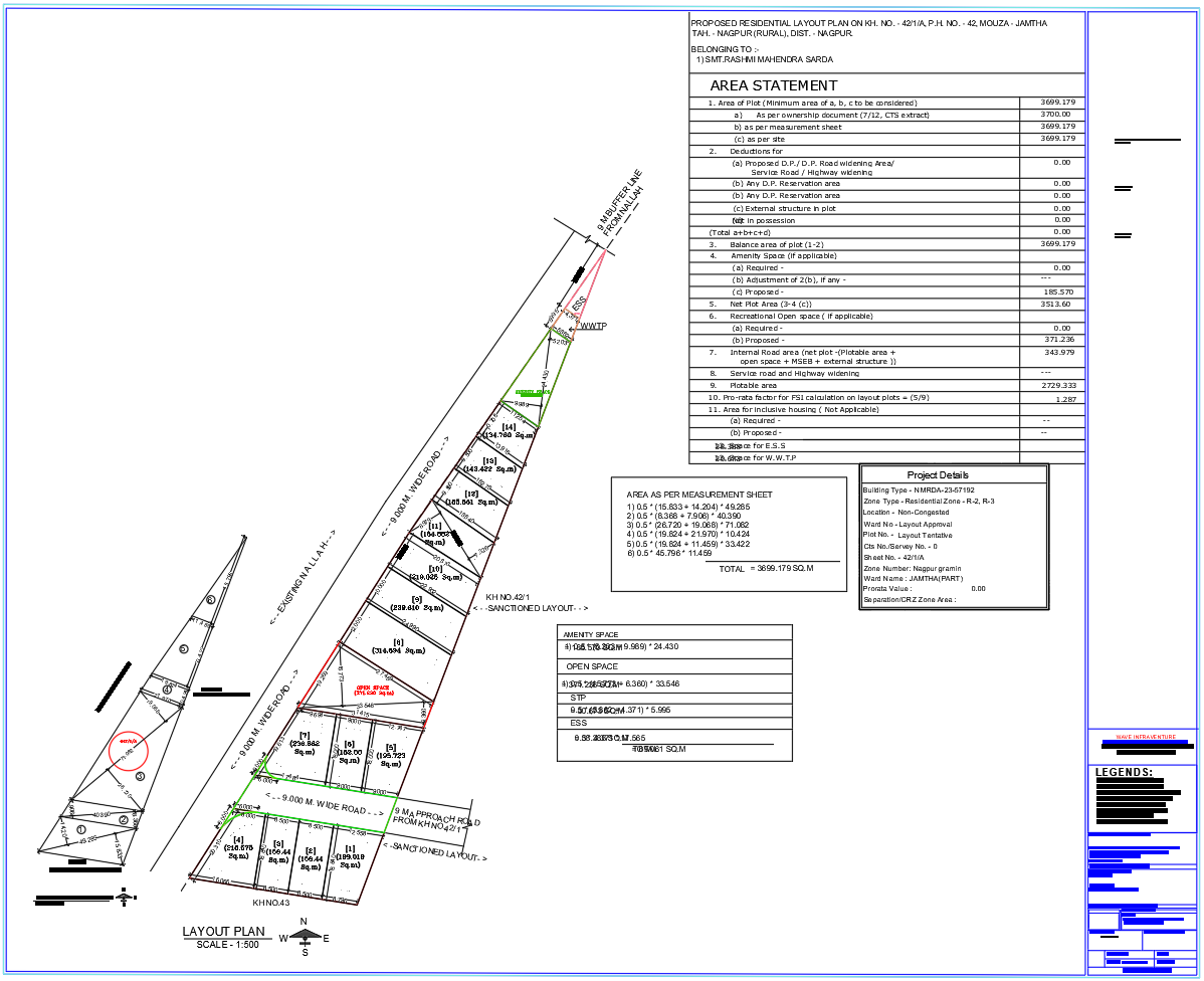
Jamtha Nagpur Residential Layout Plan 3699 Sqm Road Network Design

Ratings & Reviews
Be the first to share your experience with this product. Your review helps others make better decisions!
Description
This AutoCAD DWG residential layout plan illustrates a proposed housing development at Jamtha Nagpur covering a total plotted area of 3699.179 square meters under Residential Zone R 2 and R 3. The drawing clearly presents internal road networks with defined widths of 9.0 meters, 6.0 meters, and 12.0 meters, ensuring smooth vehicular circulation and compliant access planning. Individual residential plots are accurately dimensioned and numbered with clear boundary markings. The layout also identifies dedicated amenity space measuring 185.57 square meters, recreational open space of 30.67 square meters, and utility allocations including an ESS plot of 38.38 square meters and a WWTP area of 69.06 square meters. Color-coded services such as drainage water supply and terrace levels enhance technical readability.
Prepared as per NMRDA town planning regulations, this DWG file includes detailed area statements, road alignment, orientation north direction, and sanctioned layout references. The plan is suitable for residential plotting approval,s infrastructure coordination, and execution level planning. Architects, civil engineers, builders, and planning consultants can use this drawing for zoning verification, service planning, and site development analysis. Accurate scale information,n plot measurements,s, and infrastructure zoning make this file a reliable reference for urban residential layout design in the Jamtha Nagpur region.
Tags
Uploaded by:
Liam
White
Ratings & Reviews
Be the first to share your experience with this product. Your review helps others make better decisions!