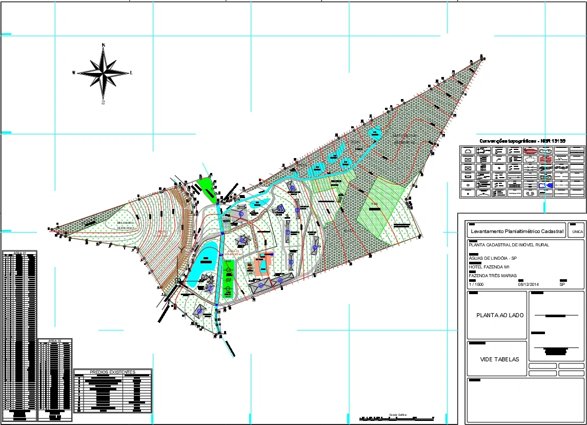
Rural Hotel Planialtimetric Survey AutoCAD DWG Layout 128300 Sqm Plan

Frequently Asked Questions
This drawing includes a complete rural hotel planimetric survey with contour lines, cadastral boundaries, roads, lakes, canals, vegetation, utilities, existing buildings, and area schedules.
E-E-A-T & Quality Verification
📝 AI Overview (TL;DR)
This Rural Hotel Planialtimetric Survey AutoCAD DWG Layout presents a 128300 sqm property at 1:1500 scale, including contour lines, cadastral boundaries, buildings, lakes, roads, utilities, vegetation, area schedules, and topographic data for accurate site planning and land development.
💡 First-hand Experience
Our team carefully reviewed this AutoCAD DWG drawing to verify the survey information, contour intervals, cadastral boundaries, building footprints, area schedules, utility networks, water features, and topographic symbols. The layout clearly represents a rural hotel property with hospitality facilities, internal roads, landscaped areas, drainage, and existing infrastructure. Based on this review, the drawing provides reliable reference data for architects, civil engineers, surveyors, planners, and landscape designers involved in site planning, land development, and project documentation.
Ratings & Reviews
Be the first to share your experience with this product. Your review helps others make better decisions!
Description
Explore a detailed Rural Hotel Planialtimetric Survey AutoCAD DWG Layout prepared at a 1:1500 scale for a 128300 sqm property with an additional 27891 sqm survey area. This drawing includes complete contour lines, spot levels, property boundaries, cadastral information, topographic survey data, road access, canals, lakes, vegetation, existing buildings, utilities, and land divisions. The layout clearly presents hospitality facilities such as reception, restaurants, convention hall, guest accommodations, swimming pools, sauna, sports courts, farm area, landscaped zones, and service buildings with accurate area schedules and measurement tables. It also features north direction, topographic symbols based on survey standards, coordinate references, boundary dimensions, drainage features, elevation details, and existing infrastructure for planning and development




Tags
Uploaded by:
Umar
Mehmood
Frequently Asked Questions
This drawing includes a complete rural hotel planimetric survey with contour lines, cadastral boundaries, roads, lakes, canals, vegetation, utilities, existing buildings, and area schedules.
E-E-A-T & Quality Verification
📝 AI Overview (TL;DR)
This Rural Hotel Planialtimetric Survey AutoCAD DWG Layout presents a 128300 sqm property at 1:1500 scale, including contour lines, cadastral boundaries, buildings, lakes, roads, utilities, vegetation, area schedules, and topographic data for accurate site planning and land development.
💡 First-hand Experience
Our team carefully reviewed this AutoCAD DWG drawing to verify the survey information, contour intervals, cadastral boundaries, building footprints, area schedules, utility networks, water features, and topographic symbols. The layout clearly represents a rural hotel property with hospitality facilities, internal roads, landscaped areas, drainage, and existing infrastructure. Based on this review, the drawing provides reliable reference data for architects, civil engineers, surveyors, planners, and landscape designers involved in site planning, land development, and project documentation.
Ratings & Reviews
Be the first to share your experience with this product. Your review helps others make better decisions!