Urban Landscape and Site Development Plan with Layout Details DWG
Description
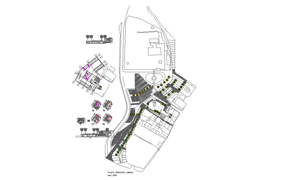
This Urban Landscape and Site Development Plan presents a detailed architectural and environmental layout through precise DWG drawings. The design integrates pathways, landscaped zones, pedestrian routes, and structural buildings arranged to support smooth circulation and functional zoning. The plan includes clearly defined road alignments, entry points, tree placements, and organised public and private areas. Each element is arranged to form a cohesive urban layout that balances infrastructure with natural surroundings. The drawing also highlights open spaces that improve airflow, accessibility, and visual connectivity across the site.
The layout demonstrates efficient land use planning, combining modern architectural elements with sustainable green design principles. The arrangement of open courtyards, walkways, and recreational spaces enhances community engagement and overall livability within the development. This design serves as a valuable reference for architects, civil engineers, and urban designers involved in city planning, institutional campus development, or mixed-use projects. The detailed distribution of spaces supports practical site organization, landscape integration, and circulation design. With accurate representation and thoughtful planning concepts, this DWG file is an ideal resource for both educational learning and professional urban development projects.

Uploaded by:
Liam
White