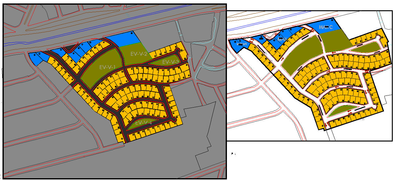
Town Planning Society DWG with Plot Layout Roads and Green Zones

Ratings & Reviews
Be the first to share your experience with this product. Your review helps others make better decisions!
Description
This Town Planning of Society DWG presents a complete layout design of a residential township, featuring organized plot distributions, internal road networks, landscaped gardens, and community utility spaces. The drawing highlights clearly marked residential plots arranged along curved and straight road alignments for smooth vehicular movement. Open green areas, designated club house zones, playground pockets, and community gathering spaces are strategically located to support modern township living. Pathways, approach roads, buffer zones, and site boundaries are accurately illustrated to reflect realistic zoning and accessibility planning.
The DWG also includes color-coded plot clusters, commercial pockets, amenity areas, and parking provisions, making it useful for developers, architects, and urban planners. The layout showcases hierarchical road planning, pedestrian-friendly pathways, and balanced land use distribution for a self-sustaining community. Stormwater routes, site levels, and boundary markers are presented with clarity, making this drawing ideal for planning approvals, client presentations, and township concept development. This file serves as a complete design reference for societies, residential clusters, plotted developments, and integrated township projects.
Tags
Uploaded by:
Liam
White
Ratings & Reviews
Be the first to share your experience with this product. Your review helps others make better decisions!