Clinic Centre Detail with Site Location and Full Plan Layout DWG
Tags
Ratings & Reviews
Be the first to share your experience with this product. Your review helps others make better decisions!
Description
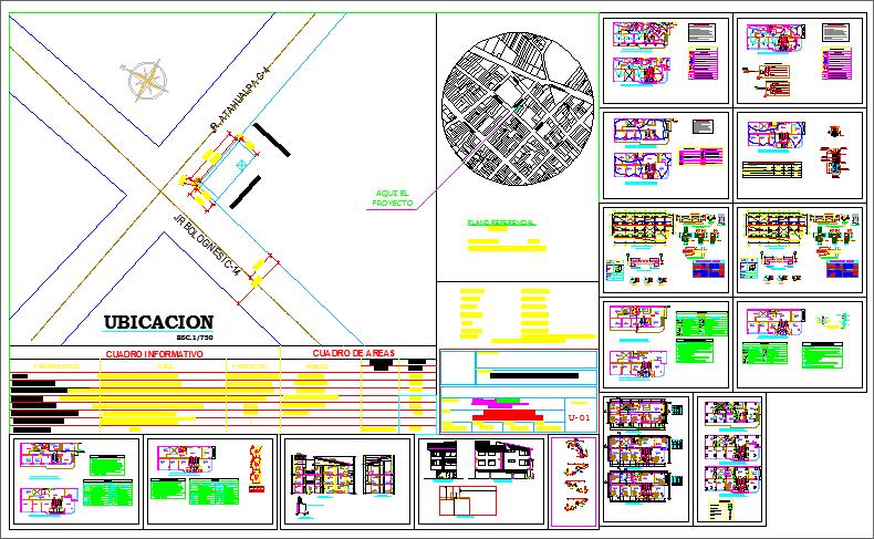
This AutoCAD DWG file provides a complete Clinic Centre Detail Plan, showing the full site location, plot position, and surrounding road network. The drawing includes a detailed Ubicación plan at scale 1:750, marking the clinic’s placement at road intersections and showing the nearby urban layout. A circular locality map highlights the clinic’s position within the city grid for better orientation. The sheet also contains a comprehensive information chart and area chart, listing room types, surface areas, and functional divisions used in clinic design and planning.
The bottom section presents multiple floor plan layouts, including treatment rooms, consultation areas, waiting zones, service spaces, staircases, and circulation routes. Elevation drawings and sectional views illustrate façade details, vertical alignment, and structural distribution. Color-coded layers help users identify walls, fixtures, doors, windows, and other architectural components. This DWG file is suitable for architects, civil engineers, planners, and health-facility designers who require a complete clinic plan with location mapping, area details, room arrangements, and technical drawings for design development and project execution.

Uploaded by:
Liam White
Tags
Ratings & Reviews
Be the first to share your experience with this product. Your review helps others make better decisions!