Town Planning Society DWG with Detailed Layout and Measurements

Ratings & Reviews
Be the first to share your experience with this product. Your review helps others make better decisions!
Description
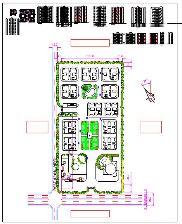
This AutoCAD DWG file presents a detailed town planning society design, including site layout, road networks, green spaces, and building placements. The plan provides precise measurements for roads, plots, parks, and community areas, ensuring a comprehensive understanding of the development. Designed for architects, civil engineers, and urban planners, the file also includes layouts for residential blocks, public facilities, and landscaping, supporting sustainable and efficient urban development.
The file is structured to showcase all key elements of a planned society, including streets, intersections, communal areas, and utility zones. Clear labeling and scalable dimensions allow for accurate project implementation and presentation. Ideal for professionals working in AutoCAD, Revit, 3D Max, and Google SketchUp, this DWG file simplifies the design, visualization, and planning process, making it an essential resource for modern town planning projects.
File Type:
3d max
File Size:
4.1 MB
Category::
Urban Design
Sub Category::
Town Design And Planning
type:
Gold
Tags
Uploaded by:
Fernando
Zapata
Ratings & Reviews
Be the first to share your experience with this product. Your review helps others make better decisions!