Town Planning AutoCAD DWG City Map Layout with 5km Area Drawing
Tags
Ratings & Reviews
Be the first to share your experience with this product. Your review helps others make better decisions!
Description
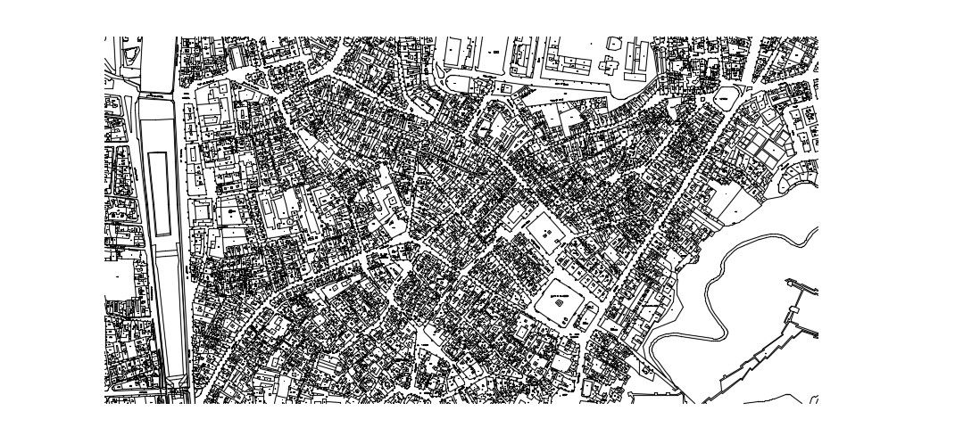
This town planning AutoCAD DWG file presents a detailed city map layout covering an approximate planning area of 5 square kilometers with clearly defined residential, commercial, and public utility zones. The drawing includes complexes, office blocks, housing clusters, landscaped gardens, bus stations, road networks, and bridge connections. Main arterial roads are shown with an average width of 24 meters, secondary roads of 12 meters, and internal streets of about 6 meters for smooth traffic circulation. Plot boundaries, building footprints, open spaces, and water body edges are accurately marked with standardized line types and symbols. This town planning drawing supports urban design analysis, zoning studies, and infrastructure coordination for professional development projects. The layout also displays junction spacing, block dimensions, pedestrian pathways, and transport connectivity for effective land use planning. This AutoCAD DWG file is compatible with AutoCAD, 3ds Max, Revit, and SketchUp, enabling easy editing, scaling, and integration into GIS and BIM workflows.
Uploaded by:
helly panchal
Tags
Ratings & Reviews
Be the first to share your experience with this product. Your review helps others make better decisions!