Tacna Urbanization Division Planning Layout with Contour Grid Detail
Tags
Ratings & Reviews
Be the first to share your experience with this product. Your review helps others make better decisions!
Description
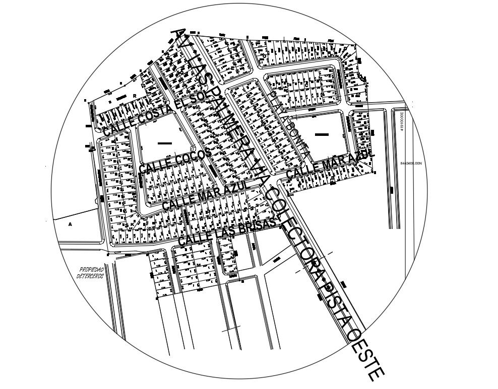
Tacna Urbanization Division Planning Layout presents a detailed city land subdivision plan for new Tacna showing updated district areas, structured plot divisions, and an organized road network system. The drawing defines residential blocks, internal streets, main access roads, and clearly segmented land parcels arranged within a coordinated urban framework. Street names, boundary alignments, and quadrant divisions are mapped for precise land identification and development execution. The layout reflects systematic urbanization planning with evenly distributed house plots and interconnected circulation routes to support future infrastructure and community growth.
Uploaded by:
Priyanka Patel
Tags
Ratings & Reviews
Be the first to share your experience with this product. Your review helps others make better decisions!