Catastral Chulucanas Urban Plan DWG File with District Layout
Tags
Ratings & Reviews
Be the first to share your experience with this product. Your review helps others make better decisions!
Description
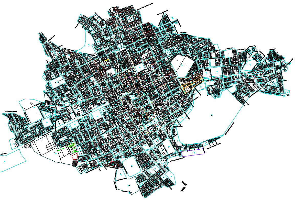
This Catastral Chulucanas Urban Plan DWG File presents a detailed historical and administrative city layout prepared in AutoCAD format. The drawing illustrates complete district boundaries, cadastral parcel divisions, road networks, block segmentation, and structured land use planning. Residential sectors, commercial zones, institutional areas, and open spaces are clearly mapped to support government level planning and urban management. The plan reflects organized street grids, intersection alignments, and defined lot structures for accurate cadastral reference and documentation.
Uploaded by:
Albert stroy
Tags
Ratings & Reviews
Be the first to share your experience with this product. Your review helps others make better decisions!