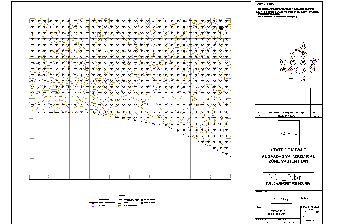
Land contour topography layout plan with elevation survey detail
Tags
Ratings & Reviews
Be the first to share your experience with this product. Your review helps others make better decisions!
Description
This land contour topography layout plan with elevation survey detail drawing presents a detailed site analysis used for land development and engineering planning. The drawing illustrates multiple contour lines representing ground elevation changes across the site, along with grid references and survey points used to measure terrain levels. The land contour topography layout plan with elevation survey detail helps architects, civil engineers, and planners understand the natural slope, land gradient, and elevation variations within the project area. Contour intervals and topographic references allow professionals to study terrain characteristics and plan construction activities according to existing land conditions.
Uploaded by:
K.H.J Jani
Tags
Ratings & Reviews
Be the first to share your experience with this product. Your review helps others make better decisions!