The Technical Training Center Location Plan DWG with Area Map
Tags
Ratings & Reviews
Be the first to share your experience with this product. Your review helps others make better decisions!
Description
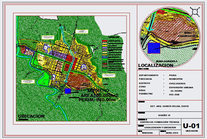
This technical training center location plan DWG file provides a detailed site identification and urban context drawing prepared for institutional development projects. The layout includes a colored zoning map showing residential, commercial, green belt, and expansion areas surrounding the project site. It clearly marks the selected plot highlighted in red within the city grid, connected by major road networks and natural water bodies. The drawing specifies an approximate site area of 50000 square meters and a perimeter length of about 940 meters for accurate land reference. A magnified circular inset map is also provided to indicate precise localization within the regional boundary and urban framework. The AutoCAD location drawing for the technical training center is compatible with AutoCAD 3d Max Revit, and Google SketchUp for planning and documentation use.

Uploaded by:
Fernando Zapata
Tags
Ratings & Reviews
Be the first to share your experience with this product. Your review helps others make better decisions!