Nagar Panchayat Master Plan Map with Land Use Zoning Detail CAD File
Tags
Ratings & Reviews
Be the first to share your experience with this product. Your review helps others make better decisions!
Description
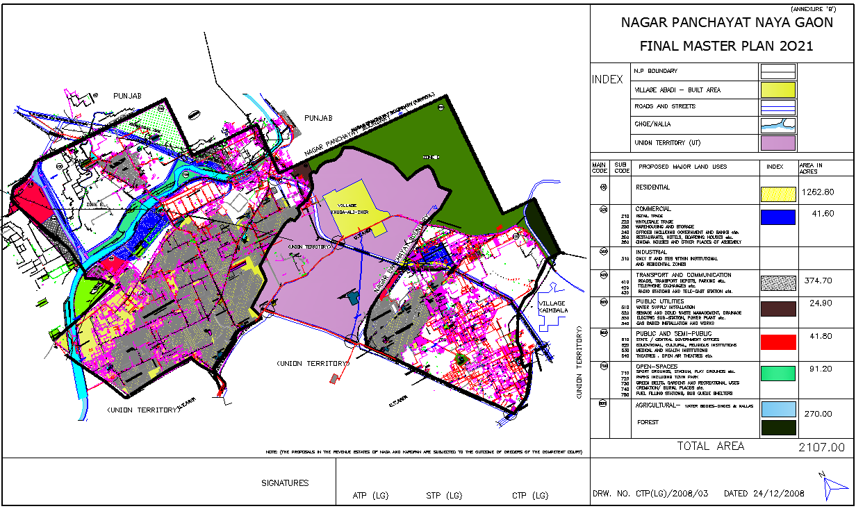
This CAD file presents a detailed Nagar Panchayat master plan map including comprehensive land use zoning, road networks, and infrastructure planning. The drawing highlights various zones such as residential, commercial, industrial, public utilities, transportation, and open spaces with clear color-coded representation. It also includes boundaries, village areas, drainage systems, and road connectivity, providing a complete overview of urban planning and development strategy. The file is ideal for urban planners, architects, civil engineers, and government authorities involved in town planning and development projects.
Uploaded by:
K.H.J Jani
Tags
Ratings & Reviews
Be the first to share your experience with this product. Your review helps others make better decisions!