Innovative Town Planning DWG with Complete Urban Development Layouts
Description
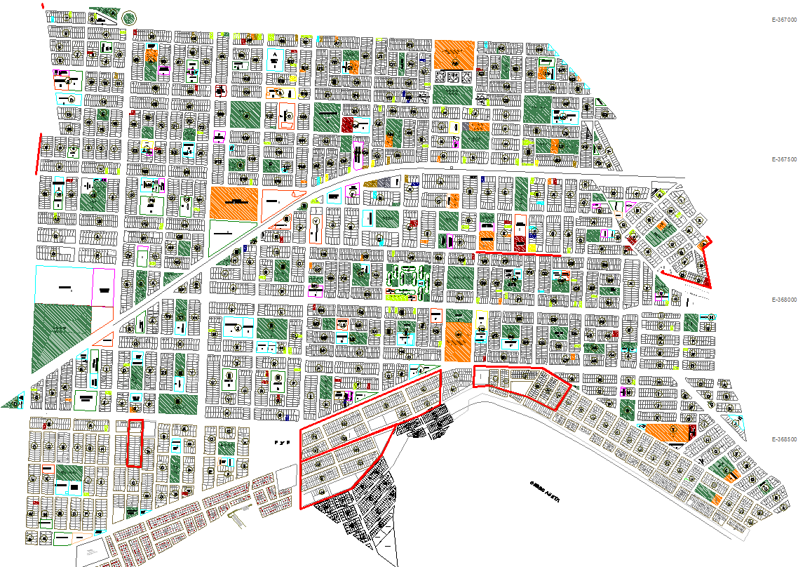
This detailed AutoCAD DWG presents an innovative town planning layout designed for modern urban development needs. The drawing includes complete zoning divisions, residential plots, commercial blocks, community facilities, schools, health centers, green parks, institutional areas, and large open spaces. The map shows an interconnected road hierarchy featuring main arterial roads, secondary streets, pedestrian pathways, and service lanes designed to create efficient circulation across the urban grid. Highlighted boundary zones indicate development phases, special-use land areas, and reserved public utility zones. The plan also illustrates plot measurements, block patterns, and grid-based street alignment for accurate implementation.
Additionally, the DWG provides comprehensive urban distribution layouts such as parking zones, recreational areas, neighborhood public spaces, green belts, and civic infrastructure. The inclusion of landscape markers, landmark icons, zoning colors, and development symbols helps professionals understand land use patterns clearly. This town planning DWG is ideal for architects, civil engineers, urban planners, GIS teams, builders, and AutoCAD users looking for a ready-to-use urban development reference. It helps streamline city planning, improve land allocation decisions, and enhance project feasibility through well-organized technical mapping. Download this file to speed up your urban design workflow with a complete planning blueprint.
File Type:
3d max
File Size:
7.1 MB
Category::
Urban Design
Sub Category::
Town Design And Planning
type:
Gold

Uploaded by:
Harriet
Burrows