Water Therapy Center Layout Plan with Site Location in DWG File
Tags
Ratings & Reviews
Be the first to share your experience with this product. Your review helps others make better decisions!
Description
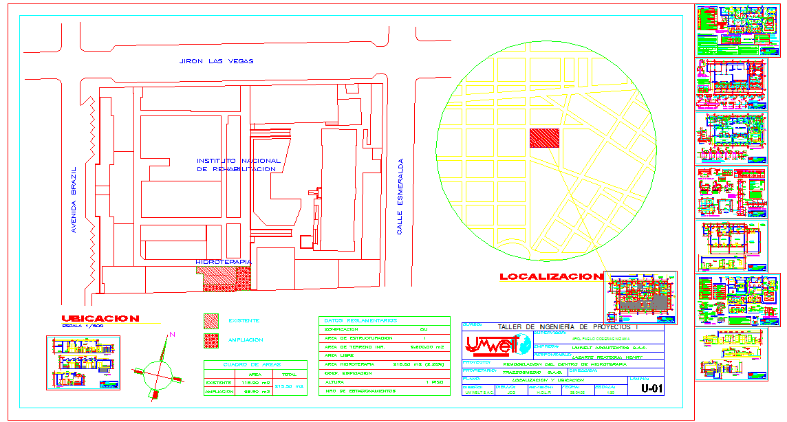
This AutoCAD DWG file provides a complete Water Therapy Center Design, showing the full site location plan, hydrotherapy area layout, and surrounding urban streets. The drawing includes a clear site map that identifies the project near Avenida Brazil, Jiron Las Vegas, and Calle Esmeralda, helping users understand the exact access points and circulation routes around the facility. The hydrotherapy zone, labeled as Hidroterapia, is shown with separate markings for existing construction and planned expansion areas, with each section identified using different hatch patterns. A detailed area chart lists the measurements for both the existing spaces and the extension area to support accurate planning and design coordination.
The sheet also contains zoning information, land area values, regulatory details, and an identification block from the design studio. A round location map highlights the position of the water therapy center within the wider neighborhood grid, giving a clear visual reference for orientation. Several small preview drawings are placed along the right side of the sheet, showing additional plan layouts related to the project. The drawing uses a north arrow, legends, and scale references to ensure accurate interpretation. This DWG file is useful for architects, engineers, and designers working on water therapy center planning and documentation.

Uploaded by:
Jafania Waxy
Tags
Ratings & Reviews
Be the first to share your experience with this product. Your review helps others make better decisions!