Urban Planning Layouts with Street Network and Zoning Areas.
Tags
Ratings & Reviews
Be the first to share your experience with this product. Your review helps others make better decisions!
Description
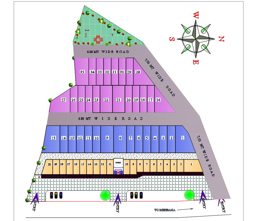
This 2D AutoCAD DWG file offers a detailed urban planning layout, including street networks, building placements, and zoning areas. The design provides a clear view of the infrastructure, such as wide roads and entries, which is ideal for city planners, architects, and civil engineers. The layout covers various zones with specified building plots, allowing for precise planning and efficient development. The urban design is suitable for projects that focus on infrastructure, city layouts, and urban development. Download the DWG file for access to a complete, professional urban planning design, perfect for executing high-level infrastructure projects.
Uploaded by:
Mehul Patel
Tags
Ratings & Reviews
Be the first to share your experience with this product. Your review helps others make better decisions!