Urban City Layout DWG with Roads Parks Blocks and Site Planning Detail
Description
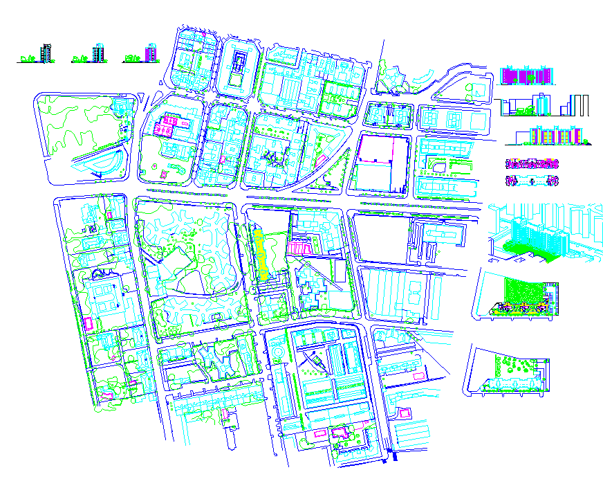
This urban city layout DWG file presents a comprehensive land-use plan with detailed road networks, residential blocks, commercial zones, parking areas, landscape patches, and organized building footprints. The drawing includes well-defined walkways, parks, green belts, public amenities, and utility corridors arranged in a clear and functional layout. Multiple plot boundaries, zoning divisions, and site-level markings support accurate planning for large-scale urban development. Elevation sketches and reference sections on the right side give additional clarity to building massing and facade orientation. This structured layout helps architects and civil engineers understand movement patterns, circulation flow, and land distribution.
Designed for professional planning work, the file enables easy integration into AutoCAD, Revit, 3ds Max, SketchUp, and GIS-based tools. Each section of the plan is drawn with precise dimensions, providing essential reference points for concept development, township planning, and municipal design proposals. The inclusion of block diagrams, exploded views, street alignments, and built-form outlines helps in visualizing site conditions effectively. This city layout DWG is ideal for urban designers, developers, and students working on masterplan projects requiring accurate spatial organization and zoning representation. It serves as a complete reference for designing modern cities and structured community environments.

Uploaded by:
Harriet
Burrows