Town Planning Detail with Landscape, Roads and Plot Layout in DWG
Tags
Ratings & Reviews
Be the first to share your experience with this product. Your review helps others make better decisions!
Description
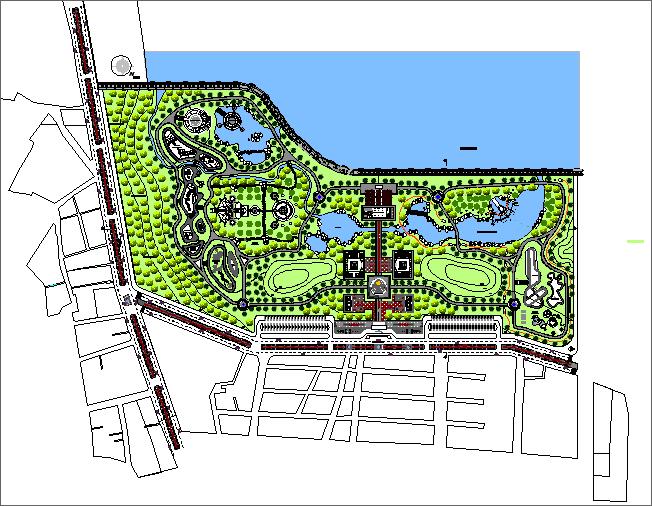
This AutoCAD DWG file presents a complete Town Planning Detail, showing a large, well-organized urban development layout beside a waterfront. The central design includes landscaped zones, pedestrian paths, curved walking tracks, water bodies, activity areas, and green spaces distributed across the site. The main axis features symmetrical gardens, open lawns, fountains, and structured landscape elements extending toward the waterfront. The drawing also shows planned circulation routes, seating areas, recreational spaces, and surrounding tree plantations, highlighted with dense greenery across the entire plan.
Residential and mixed-use zones are placed toward the lower part of the drawing, where road grids, building blocks, and plot divisions are clearly defined. The design includes access roads, parking spaces, entry points, and urban connectors linking the residential plots to the central landscaped areas. All elements are marked with detailed linework and color-coded layers for easy understanding during planning and development. This DWG is suitable for architects, urban planners, civil engineers, and landscape designers working on large-scale town planning projects with integrated residential, recreational, and public spaces.

Uploaded by:
Jafania Waxy
Tags
Ratings & Reviews
Be the first to share your experience with this product. Your review helps others make better decisions!