Municipal Town Planning Layouts with Road Network Details Plan
Tags
Ratings & Reviews
Be the first to share your experience with this product. Your review helps others make better decisions!
Description
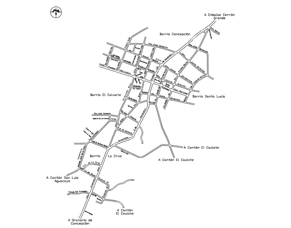
Municipal town planning layout drawing presents a complete urban road network plan with clearly divided sections and neighborhood blocks prepared in an accurate AutoCAD format. The plan shows main avenue connections, secondary streets, and internal road grids with approximate roadway widths ranging from 6.00 m to 12.00 m. Key zones such as residential blocks, public areas, and circulation routes are organized with defined plot divisions and intersection geometry. The layout includes directional references, access roads leading to surrounding cantons, and clearly marked neighborhood areas for systematic urban planning coordination.
Uploaded by:
Priyanka Patel
Tags
Ratings & Reviews
Be the first to share your experience with this product. Your review helps others make better decisions!