Urban Town Planning Design DWG with Contour Based Layout Plan
Tags
Ratings & Reviews
Be the first to share your experience with this product. Your review helps others make better decisions!
Description
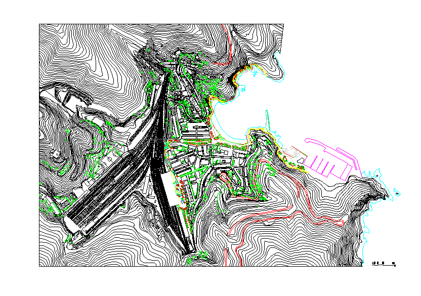
The Urban town planning design DWG with contour based layout plan presents a detailed AutoCAD drawing prepared for large-scale land development and urban planning projects. This drawing illustrates a planned town layout created with contour based site planning, helping designers understand the natural landform and terrain variations while developing urban infrastructure. The Urban town planning design DWG with contour based layout plan includes contour lines, road layout planning, land division, and organized development zones that help planners design residential and public spaces according to site topography. Such drawings are essential for understanding land levels, slope direction, and terrain conditions before beginning construction or infrastructure development.
Uploaded by:
Priyanka Patel
Tags
Ratings & Reviews
Be the first to share your experience with this product. Your review helps others make better decisions!