Urban Map Plan Layout with Zoning Road Network and Land Use Detail
Tags
#urban map layout#city map plan#urban map plan with zoning#road network layout design#urban planning drawing#map plan with dimensions#dwg files#dwg#AutoCAD files#dwg download#cad files#cad file download#dwg blocks#AutoCAD
Ratings & Reviews
⭐
No Reviews Yet
Be the first to share your experience with this product. Your review helps others make better decisions!
★★★★★
Description
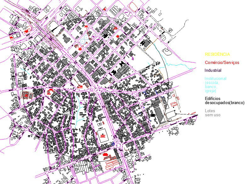
This urban map plan layout presents a detailed architectural drawing, including zoning distribution and road network planning. The map illustrates organized land use areas such as residential, commercial, industrial, and institutional zones with clear demarcation. Street layouts, intersections, and circulation paths are accurately defined to support urban planning and development. Structural grid references and dimensions enhance understanding of spatial organization.
Uploaded by:
K.H.J Jani
Tags
#urban map layout#city map plan#urban map plan with zoning#road network layout design#urban planning drawing#map plan with dimensions#dwg files#dwg#AutoCAD files#dwg download#cad files#cad file download#dwg blocks#AutoCAD
Ratings & Reviews
⭐
No Reviews Yet
Be the first to share your experience with this product. Your review helps others make better decisions!
★★★★★