Town Planning Master Plan AutoCAD Drawing with Zoning and Measurements
Tags
Ratings & Reviews
Be the first to share your experience with this product. Your review helps others make better decisions!
Description
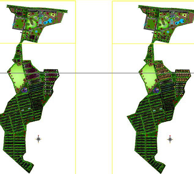
This town planning master plan AutoCAD drawing presents a comprehensive site-level layout prepared for large-scale residential and mixed-use development. The drawing clearly illustrates land zoning for residential plots, apartment blocks, internal road networks, landscaped green belts, open parks, community facilities, and utility areas. Plot divisions are systematically arranged with uniform spacing, road widths, junction layouts, and circulation planning to support smooth traffic movement. The master plan includes clearly marked measurements for plot dimensions, road offsets, setbacks, and open space ratios, making it suitable for statutory planning review and execution.
The AutoCAD file also highlights essential urban infrastructure elements such as clubhouse zones, educational buildings, healthcare facilities, recreational areas, and service corridors. Landscaping layouts, green buffers, and pedestrian pathways are integrated with the road network for balanced urban planning. This drawing is useful for architects, town planners, civil engineers, and developers who require an accurate reference for township planning, zoning control, and large residential society development with measurable and scalable planning data.
Uploaded by:
kajan thiyagarajah
Tags
Ratings & Reviews
Be the first to share your experience with this product. Your review helps others make better decisions!