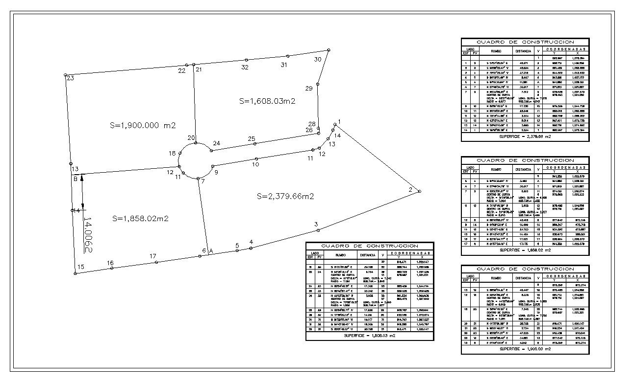
Plot Detail CAD Drawing with Area Calculation and Coordinates
Tags
Ratings & Reviews
Be the first to share your experience with this product. Your review helps others make better decisions!
Description
Plot Detail CAD Drawing with Area Calculation and Coordinates is a professionally prepared AutoCAD DWG file presenting a complete land parcel layout with boundary dimensions and survey references. The drawing includes plotted boundary lines with numbered points, angular measurements, linear distances, and clearly marked total land areas such as 1900.000 m2, 1858.02 m2, 1608.03 m2, and 2379.66 m2. A circular road junction connection and internal plot division lines are also illustrated for accurate site interpretation and subdivision planning.

Uploaded by:
john kelly
Tags
Ratings & Reviews
Be the first to share your experience with this product. Your review helps others make better decisions!