Urban Town Planning Layout with Roads Zones and Public Infrastructure
Tags
Ratings & Reviews
Be the first to share your experience with this product. Your review helps others make better decisions!
Description
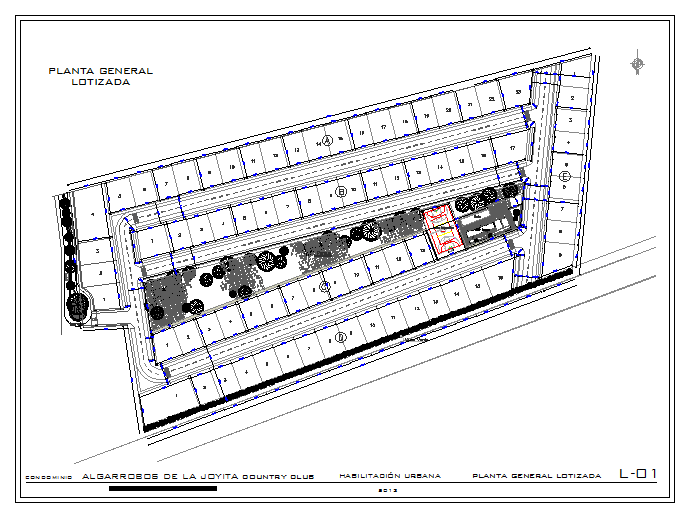
This Urban Town Planning drawing provides a detailed AutoCAD layout for city and town development projects. The plan includes road networks, residential and commercial zones, public infrastructure, parks, and open spaces with clear measurements and layout alignment. It supports functional planning, zoning regulations, and sustainable urban design principles. Wall thickness, plot boundaries, and circulation paths are accurately defined for professional planning and coordination. This DWG drawing is suitable for architects, civil engineers, urban planners, and builders. It can be integrated with Rivet, 3d Max, and SketchUp for 3D visualisation, planning presentations, and project execution, ensuring practical and organised urban layouts.

Uploaded by:
Jafania Waxy
Tags
Ratings & Reviews
Be the first to share your experience with this product. Your review helps others make better decisions!